maanantai 23. marraskuuta 2015

Climbing Parinacota 6347m

In La Paz it has been raining often lately and the mountains surely have been receiving a lot of fresh snow. The best season for climbing is gone around here but for the past 4,5 months I didn't think about climbing much. Then I decided I wanted to go climb Parinacota on the Chilean border to still climb at least something this year. That part of Bolivia had still been very sunny and forecast looked good. This time I asked two other people to go with me and both were able to come so we were three. One of them was from Finland, living in La Paz, and one was Bolivian.

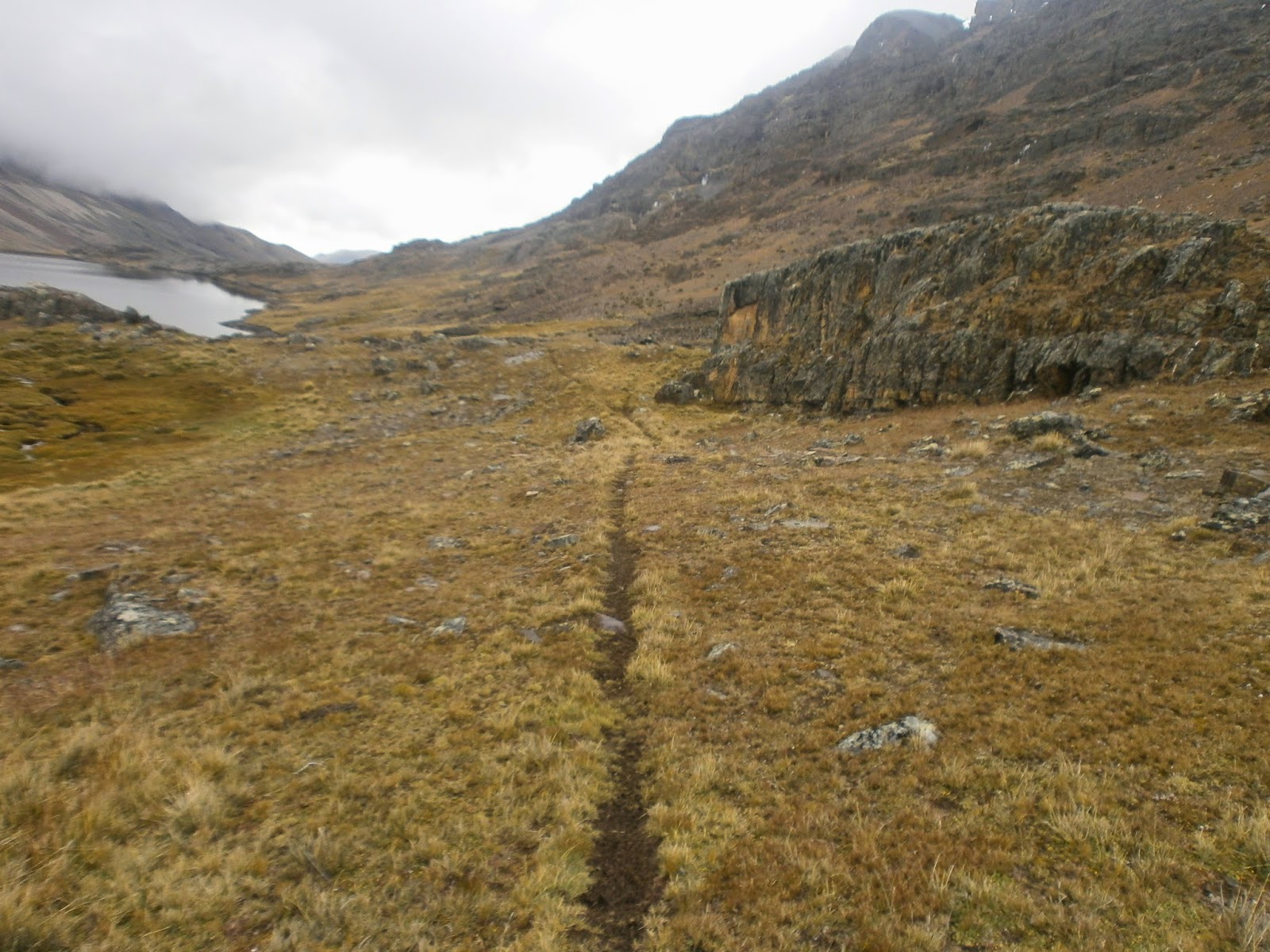
After just over 5 hours including a few stops, we were in the sleepy village of Sajama. We stopped there shortly to ask about a mountain hut that is not working but if you find the right person you might get the key to enter the hut. A woman in a hotel said we should try to find señor x around the plaza, who might know more. Instead, we kept on driving toward the mountains ready to spend the night in a tent. The terrain is all soft sand mixed with volcanic ash, and it's like driving on a sandy beach. At one point we got stuck in the sand going up a slight hill, and it took quite a while to get moving again even using 4x4. The other Finn thought my car might have what's in Spanish called "4x4 bajo" which is one more speed or gear while using the 4x4. I thought 4x4 was either on or off, but in fact learned that there is more to it, and that's how we got out of the sand and I turned the car around and drove back a little bit on top of a small hill. Now we most likely would have been able to clear the hill where we got stuck, but I was a little bit worried about the engine overheating because it had taken great efforts to get out of the deep sand. Also we believed the base camp and the mountain hut were not far. One estimate was that it was 1 kilometer away! So we started walking in the soft sand and very strong wind and with very heavy backpacks and a lot of bottled water from 4415 meters/ 14,500ft of elevation. We were quite hopeful that the walk wouldn't very long and after about 1,5 hours we were getting a little bit tired. Our goal was to get to the hut to be able to rest and eat next to it, protected from the wind and then keep on walking higher to camp. But hours passed and we never saw it. Suddenly it got really cold when the sun disappeared behind the mountain and we were at 5100m/ 16,700ft. There was a big rock behind which we thought we might have to camp even though it was not a flat area. Me and Javier decided to leave our backpacks and take a last look just a little bit further, just in case we would see a better camp spot. After about 400m of walking he saw the hut among huge rocks, and we returned to our backpacks to walk the last hundreds of meters of the hard day. In the end we had walked 7,1km or 4,5 miles with super heavy loads gaining over 700m of altitude in the soft sand.

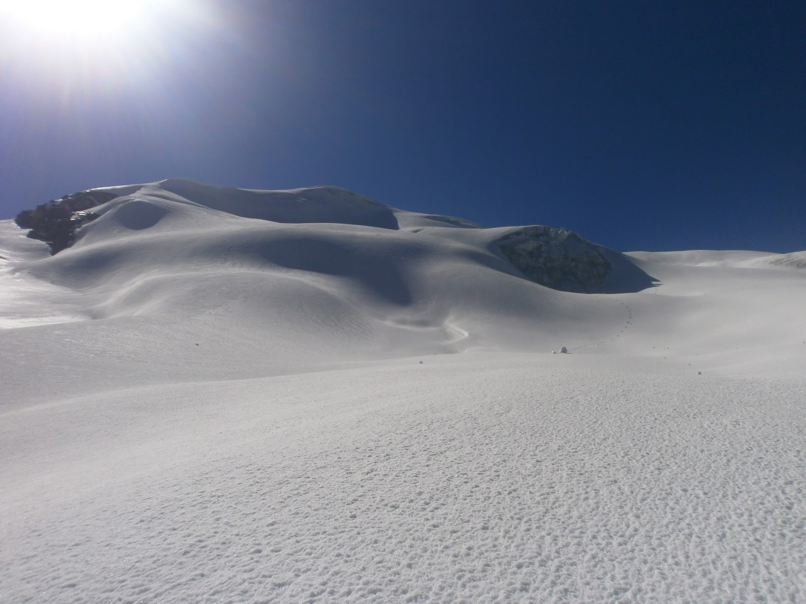
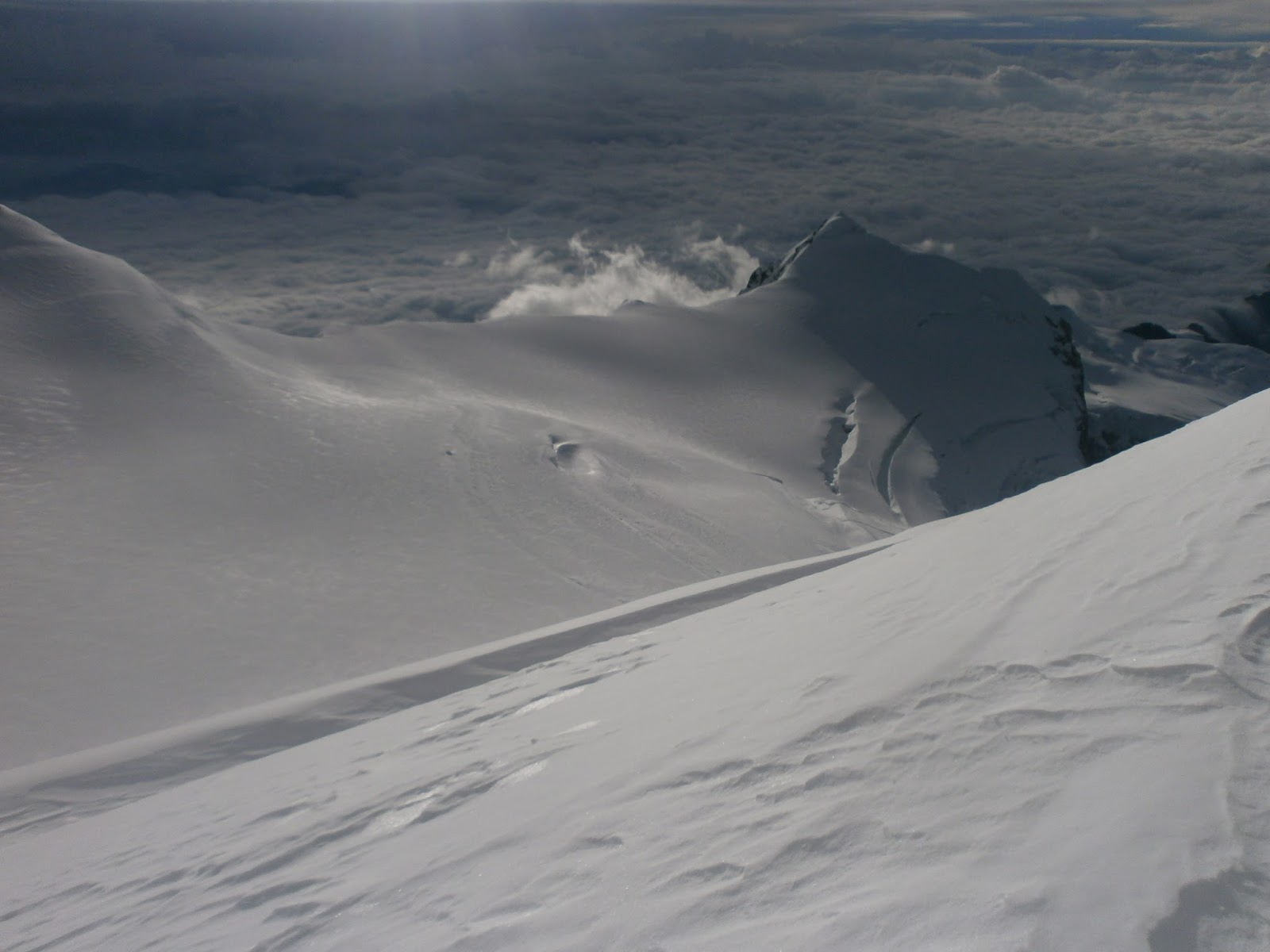
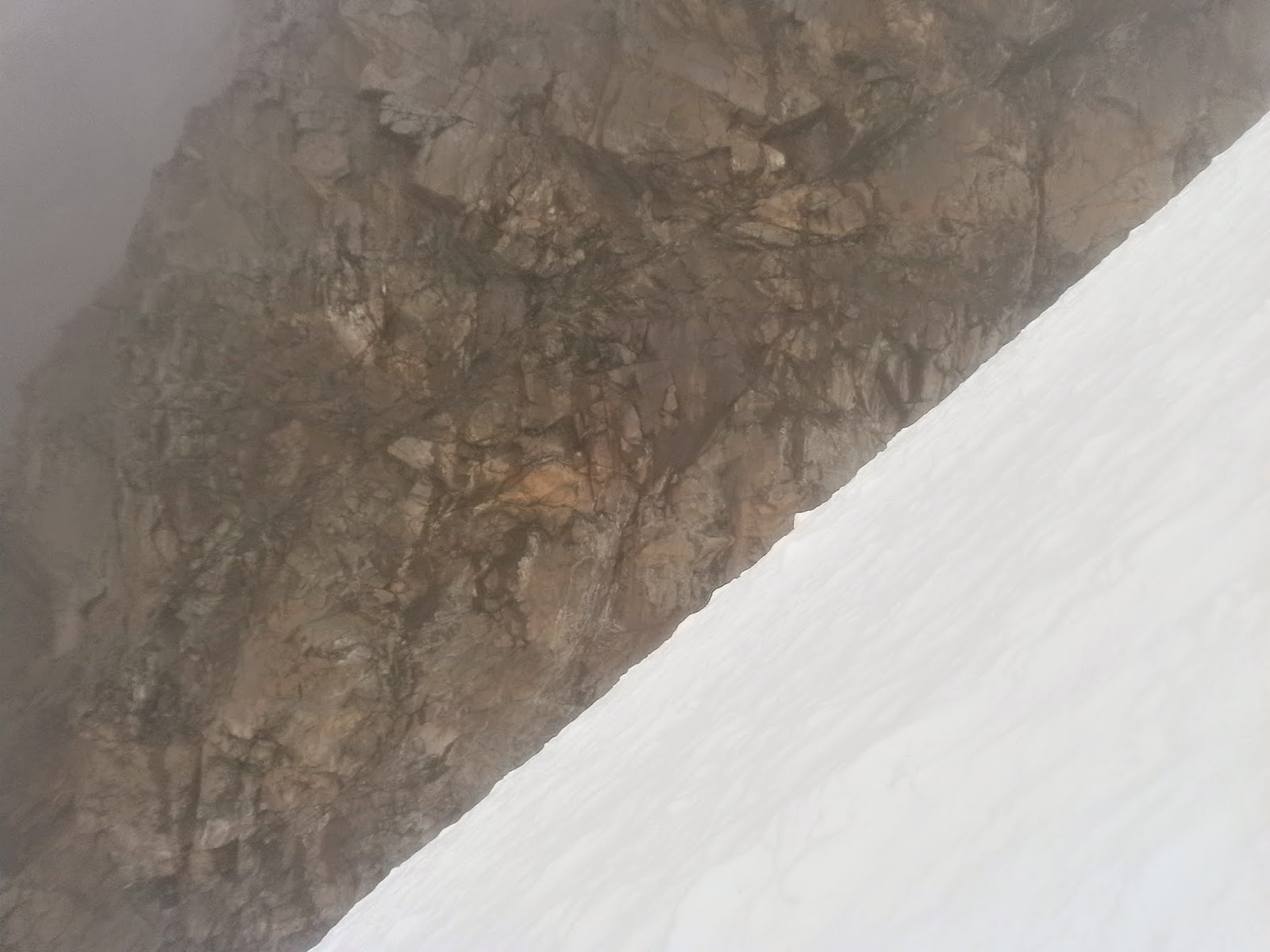
Then Javier, who arrived first, tried the door and it was open! We couldn't have been happier or more surprised. The hut had 8 bunk beds, water and gas for cooking, and electricity from a solar panel. Needless to say it was a lot warmer inside than outside in the wind. The rocks outside around the hut were about the size of a cargo van and much bigger, with mostly very straight lines and would have provided some shelter from the wind, and the sand might have been nice and soft for sleeping, but there is nothing like getting to sleep inside in a bed after a hard day when it's cold and windy outside. Not to mention how much space we had inside. We ate and then went to bed at 7.45pm. As expected, I didn't sleep much, maybe 3-4 hours of really being asleep. In the night the clear sky was incredibly full of stars. My buddies slept about 10 hours which time I also spent in my sleeping bag. It was quite late 6.30 am when we started the walk toward the snow and the top.First it was about an hour in the sand, then when it got steeper, it was better to walk and climb over rocks instead of the soft sand. It took hours for us to get close to the snow. Because it's November and it has not been snowing much in months, the snow has been burned off by the sun until very high on the mountain. I think the snow started at 5800m 19,000ft. There the other Finnish man had to stop and go back down. The neighboring Pomerape had snow from about 5300 meters or 17,400ft at least on two southern slopes so maybe Parinacota too had more snow on its other sides. At first it was great fun going up or around the nieve penitentes that were about 1 meter tall or less but of course it was really slow and tiring too. Again it took hours to get to the next stage which was icy ladders. I'm glad it was like that and not straight ice.


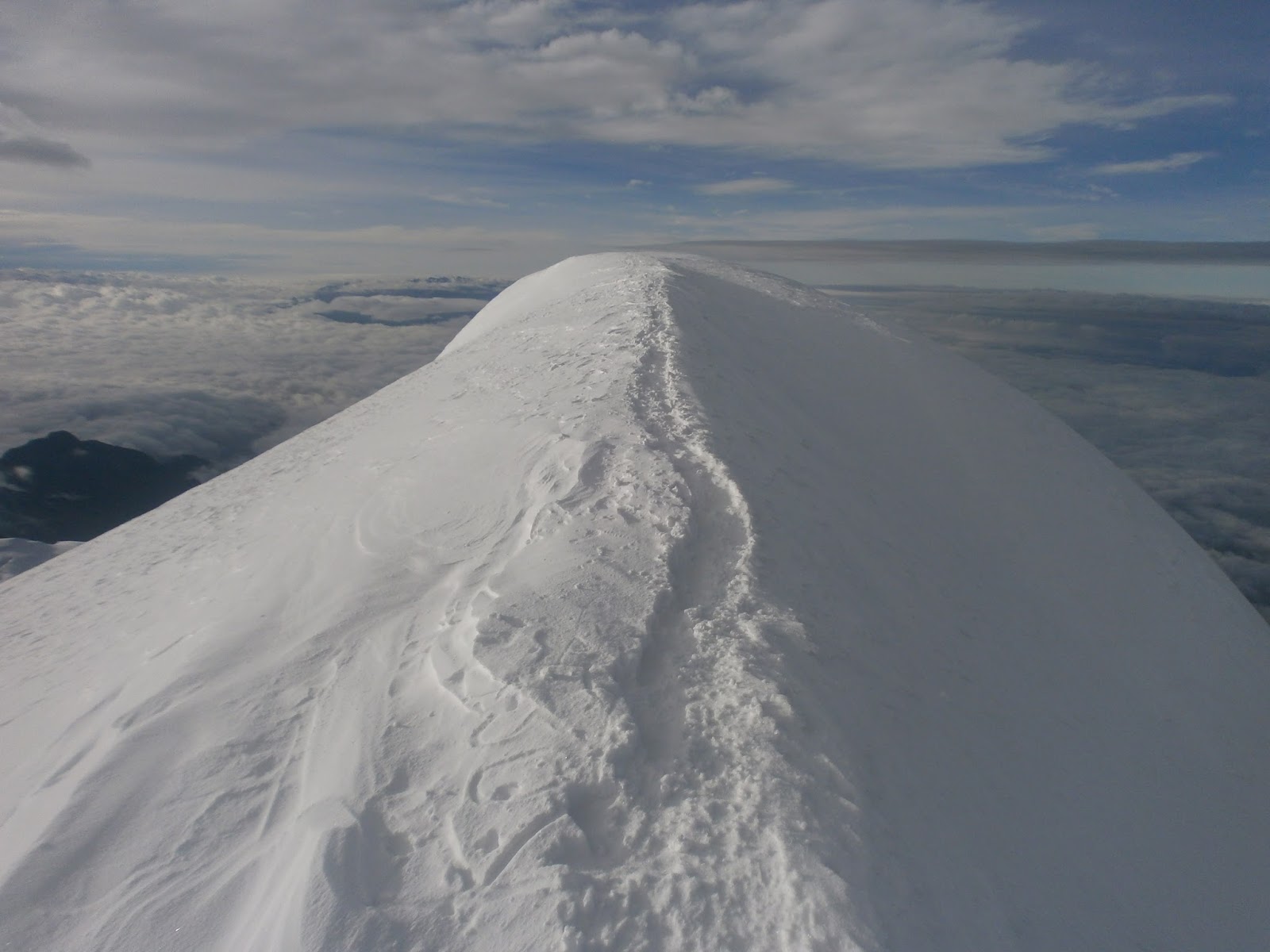
The last step was 20 vertical meters loose rocks. This was a lot harder than I thought and very slow because there was a thin layer of quite small rocks on top of a surprisingly hard ground, so it was slippery. Eventually I got to the crater rim to wait for Javier who got up 15 minutes later still in his crampons. I should have done the same instead of taking them off. On the top it was windy and there were some snow lines. First we went to the left and then to the right while looking for the highest spot and my gps showed 6347 meters 20,820ft.


I'm not sure we stood on the highest spot, maybe not, but that's ok. The ascent took so long because there was so little snow, and no good snow at all. We didn't have the energy or the time to walk the whole crater. After almost exactly 12 hours we were back at the hut, exhausted. Ate and went to sleep before 8 without a clear plan for the next day but it was our goal to attempt also Pomerape which is almost as high and over 6200 meters . Again, everyone slept or rested for about 9,5 hours. In the morning I felt terribly tired and generally bad, and so did Javier who had been a little sick, and Jari was perhaps in the best shape of us. We "decided" to go for Pomerape, but gave up before leaving the hut : D It was just impossible. I had slept really poorly and very little for the last three nights. Had we arrived all the way to the hut in a car, we would have been in much better position, but now the first day's walk had been a lot for us. I barely made it to the car that day in about 2,5 hours. At least one total rest day would have been required for us to try Pomerape, probably two days of just resting. So, walking 7km to the car was no rest and the next day should have been a rest day, but we went home. Maybe there will be one more trip to those mountains later.

lauantai 19. syyskuuta 2015

Triathlon nationals in Santa Cruz

In May and June I was 2 months without running, and about 6 weeks without cycling or swimming. I just went to the mountains, but of course that helped to maintain some fitness. After that, training has been going quite well but mostly I've been doing just about 10 hours a week while now working 30hours a week. Once I managed 20 hours of training in 7 days.

On Sunday September 13th there was another Bolivian championships triathlon. A strange thing about triathlon here is that there are 3 nationals each year, and every time the distance is the same. Normal would be having a sprint, olympic distance, half distance and even full distance nationals. For example, in the Bolivian "elite" category the distance is always draft legal olympic distance 1500m- 40km- 10km but I think sometimes they make an exception and make it a sprint if there is an international sprint championships race coming up and the winner goes to the games.
 Age groups here begin from 7 years old and there are some that are over 60 and compete. There is an "elite sprint" category for people 16-19 years old, and then there's another category for competitive 20-23 year olds who don't want to compete in the "elite olimpico" and I think that's on top of the age groups. Adults also have their own non- age group, non- elite, kind of in-between championship category "mayores".
  Once again it would have been a 17-hour bus trip, so I flew to Santa Cruz the day before the race. Based on information I had before the race, I thought I was going to race at 7.30 in the morning but it turned out that it would be at 11 or 12, nobody really knew. In the morning I went to the race site early with the La Paz team. It was about 30 minutes from the hotel. I waited all day and finally our race started at 2.30. Everybody was really hungry beginning the race. The swim was in a 3-lane 50 meter outdoor pool (next to it was an indoor 25m pool). The pool was horribly cold. The coldest pool I have ever entered. Santa Cruz has a hot climate most of the year and it's quite close to sea level at 400m of elevation. We were lucky to have cool weather that weekend. I swam a 23.00 or 23.02. Pretty good for me (no flip turns allowed) but after so much training and living at around 3600m or 12,000ft I couldn't quite get everything out swimming fast close to sea level. Maybe should have just tried harder. But this time I was "only" 2.35 min behind the fastest swimmer. In transition I forgot my number hand lost 20-30 seconds going back to get it. Or I had thought it was not needed for the bike leg but some people told me to go get it so I did.
 The bike course was 16 laps, each including two u-turns and 6 90 degree turns. It was also quite hilly so it was a really really slow course. The city of Santa Cruz is totally flat, but once you cross a river on the west side, it's hilly. Inevitably the two fastest swimmers got together, and I was told that soon they were a group of 5 together, because you couldn't get disqualified for getting lapped. I had company for about one lap but got no help so in reality I rode solo the whole time. Bike time was just about 1.08 and I was still 2 minutes behind, and in 3rd place. I ran really well and passed 2nd place after 1.5km but it took almost until km 9 till I was with the leader. I tried to drop him but it didn't work, so then we took it easy for about 1km. In the last, long hill we sprinted, then sprinted a slight downhill to the finish line and in the end I lost by 1 or 2 seconds. I think it has been 9 years since I've had so much lactic acid in my legs running. I forgot to stop my watch but run time was about 39 for the hilly course that totaled 10.3km and the last km was slow except the end. Finish time was 2h.13 minutes. Overall I'm in the best shape since end of 2013 so I think I'll keep training.

I lost my return flight by 4 hours but only had to pay about 17 dollars to take the last flight of the day. Very nice.

maanantai 29. kesäkuuta 2015

Climbing Maria Lloco

Maria Lloco is a 5552 meters 18,200 ft high mountain just west of Huayna Potosi. On June 28th I left at 3.48am because I woke up early. I drove to Milluni which is close to Huayna Potosi base camp, and then onto a smaller road that went up on the south side of Huayna. I stopped at 4830 meters 15,850ft and started walking at 5.55am. It was still dark and I used my headlight but the batteries died in a couple of minutes. Full moon was only a few days away so it was not too dark without a light and at 6.30 it there was some light. That road goes to Tuni and Condoriri reaching over 5000 meters, and there is another road that goes closer to the west side of Huayna Potosi and Maria Lloco but I've read it's a private road and they charge 50 bolivianos 7 dollars to open the gate. Also I had believed the road I would be driving to be really bad, which the police in Milluni also pointed out, but it was not that bad. It was quite good actually, but still I walked from the other side and had to climb up to 5245 meters and then descent a difficult rocky slope to 4750 meters again before climbing the 5552 meter high Maria Lloco. I wanted to take an intermediate route. While on the lower slopes, it looked like there was a snow slope and then a couloir leading relatively close to the summit, so I took that route which was nice and quite steep but not too steep.
When I got to the top of it and to a ridge, the summit still seemed to be far away. The ridge and the other side of the mountain were free of snow at that altitude. It was loose rock. It didn't look like something I wanted to climb so I decided to climb below the ridge on the snowy side traversing towards the summit while slowly gaining elevation among some rocks. But as soon as I left the couloir the snow turned loose sugar snow and the slope was steep. At times the snow was thigh deep and climbing was very slow. Not that much fun but eventually I reached a short snow slope leading up to a big pile of loose rock that was the summit. I took my climbing boots off for the summit. The views of the Huayna Potosi west face and the cordillera real were impressive.
  I had a feeling that going down was going to be bad. After going down the highest, rocky part, I put on my boots and crampons just to descent less than 10 minutes on snow but then I chose to take the rocky side to go down. I think I should have taken the snowy side but another route there. Going down a steep mountain side made up of loose rock is a nightmare and takes a very long time.
  I went back down to 4730 meters and on the way back to my car I took a route that gently rose up to 5100 meters on very nice terrain for walking and then on the other side the road at 5030 meters. There the road was almost flat and very good. It was 6.20 when I was back at the car so the trip took 12 hours 25 minutes car to car. That's a long long time, much longer than my typical climbs.

Maria Lloco in the morning:


Huayna Potosi's 1000m high west face from the summit of Maria Lloco:


Funny natural lines of sand and small stones.

I think I'm done with mountains for now. It's been a fun "season" of climbing and each trip has been a huge experience. My favorite was Charquini. Mururata was a good day too.

perjantai 26. kesäkuuta 2015

Acotango Climb

I drove to Sajama national park (an area that has 4 mountains over 6000 meters high) on Thursday June 18th, and from the very small Sajama village to the base camp of Parinacota and Pomerape. Or I thought it was the base camp, but later concluded it was in the next valley. I wanted to walk to the high camp and climb both mountains the next day, but after a while my backpack's left shoulder strap ripped off. Not a very good backpack. And I was carrying a lot of water. It was not too late, so I decided to make a really quick try on Parinacota. But I didn't want to leave any of my stuff outside low on the mountain because this is Bolivia, so I returned to the car and left most of my equipment in the car and took off again with smaller backpack and everything needed for a one-day attempt. By now it was almost 3pm. I climbed up until 5300 meters and estimated I could have made it to the summit just before the sun went down (of course this was a really optimistic estimate) but then thought it was better to return because I didn't feel like having an adventure in the darkness coming down. I returned to the car again.
 I thought about my options: the first one was camping where the car was at 4800 meters. It was windy and these mountains are volcanoes, and the soil is a very soft mix of sand and ash. It was quite dusty in the wind. I didn't like the idea of staying the night there because I have always tried to avoid camping alone at low elevations since I've read stories about thefts in all "major" mountain base camp sites in Bolivia. Here I hadn't seen anyone after the Sajama village that was one hour's very slow drive away, but there were a couple of houses along the way,and in this country there are usually people outside almost everywhere, except at really high elevations at 5000 meters and over. I still think it's extremely unlikely it would happen, but I just didn't want to take the risk of someone coming to wake me up in the night with a knife. And if you can rob money, why not take the car too? To be realistic, if something disappears from your remote camp in Bolivia I think they are kids stealing the stuff, not hard core criminals. Sure, almost all Bolivians I know are good people, but still a lot of people here wouldn't hesitate to steal if they have the opportunity. And many are looking for an opportunity to steal.
My car isn't very big so sleeping in it would not have been even remotely comfortable. In 2009 I made a trip to Sweden and Denmark, sleeping 4 nights pretty well in my car but it was a longer kind of car. It was a nice trip. I had a road bike with me and did rides and runs in both countries.
I made the decision to return to the village. Maybe I should have just climbed the mountain and not return and maybe I should have just camped outside, but I didn't. Not now. I didn't have the right feeling. I got lost two times, but thanks to my car being a 4x4 vehicle, I was able to make u- turns in the soft sand and not get stuck. This trip was the first time I ever had to use the 4x4. I took a hostal room for about 5$. Very cheap, but in fact the room was quite good for Bolivia.

The next morning I headed for the mountain called Acotango which is a 6052 meters or 19,855ft high mountain. As I was leaving the village I saw a tourist outside, obviously waiting for some sort of transport out of the village to the paved "highway" or the next town. In the countryside where people don't have cars and where there is very little public transportation, there are always people on the side of the road wanting you to pick them up. Driving close to Illimani a few weeks back I eventually gave up and decided to give an old man a lift since I was already driving super slow, but it turned out he was just curious and wanted to talk to me. So in general, there's no way I'm going to pick up a Bolivian stranger while driving, but a German tourist, of course. There are hot springs and geysers close to Sajama, the area is pretty, and the climbing is good so the Sajama area is a (very) minor tourist spot. Plus it's less than 3 hours from the Chilean coast and beach towns. We drove 30 minutes to the border town Tambo Quemado, talking in Spanish. From there I took a smaller road leading to Acotango. There is a good mining road going up the mountain. Up the road I saw a tractor working on the road and 3 men, and higher up a truck was coming down. I took the first spot where I could park the car because I couldn't see if there was enough room to pass. I was already at over 5300 meters! Definitely the highest I have ever driven. Also I knew the climb was not going to be very hard, but most of all, I didn't want to get on the miners' bad side. In this country they have a really bad reputation for being troublemakers, making protests and blocking the most important highways, and throwing dynamite while doing that. In Sajama I was told they would charge 100 bolivianos or 14 dollars for climbing the mountain.
The 3 men in the truck stopped to talk to me. Nice people! When I passed the tractor and the other 3 men, they wanted to talk as well. Nice people!
I walked up the road. Not because it seemed to go toward the summit, it didn't, but because I wanted to see how high it went and how good it was near the end. The snow line was maybe at 5350 meters but I have seen from pictures that later in the year there might not be snow at all. The road however was mostly free of snow and ice up until 5600 meters! Crazy. I was still quite far from the summit distance- wise. I had left the car really late by mountaineering standards at 11.20 a.m but it was ok because the mountain doesn't have glaciers, just snow. The snow was still ok the whole day, not too soft. I took a route mostly following a ridge leading to the summit. A nice route but the shortest routes would have been steeper and more exciting. No matter how short the actual climb, moving at 6000 meters is always slow and tiring and anyways it will take hours. Here is the final part of the climb:
Then the summit. My gps said 6073 meters which I have also seen online I think, but Wikipedia says 6052 meters. I continued and went down the ridge to the other side and then down a steep slope.
Overall it was a nice worry free climb with good views. Felt really safe, didn't see anything that could be dangerous. It was not windy now. Third 6000 meter mountain I have climbed during this year's mountain campaign.
I was home in La Paz at 10.30 that night. I need to go back to that area for more mountains but I'm not sure if I'll have the chance to climb more soon or if I'll have to do other things.

sunnuntai 14. kesäkuuta 2015

Climbing Mururata

Among all the people who live in and around La Paz, Mururata is the second most well-known mountain after its close neighbor Illimani. It is 5880 meters 19,300 ft high. From La Paz it is therefore the second most visible snowy mountain. Looking at it from La Paz the glacier looks very flat, but from other angles it looks less flat but still gentle.
  Saturday, June 13th I left at 5.16 am and it took just over two hours to get to where I started walking. There is a very small road that goes very close to the glacier (but not in the same valley) to over 4800 meters of altitude, but there was a 200 meter section of the road that was just really really bad, so after that I parked at the first area where it was possible. One of the things I want to avoid the most while doing these trips is getting stuck while driving a mountain road. Of course, veering off the road and tumbling hundreds of meters down would be worse, but a lot less likely than getting stuck. I think all the small roads here have parts where you can't drive where you'd normally drive, because the tire tracks can be up to 30cm deep. So, you drive on the right edge or the left edge of the road to avoid your tires falling into the deep tire tracks. When possible, it's better to take the non- cliff side.
   I was at 4230 meters of altitude and far from the glacier but I thought it was better to walk. It was 7.30 when I left the car. The walk was really easy at first and there was a path, then there were a couple of times when I had to climb a little bit of rock but it was easy too because the rocks had like natural steps. I tried and was able to move very fast. Including a couple of stops it took 2 hours 13 minutes to reach the glacier which started at 5015 meters. Entering the glacier I had walked 5,8 kilometers.

I was glad to find out that the glacier was nowhere near as easy- angled as it looks like from afar. It was not very steep, but I liked it. This is still the first part of the climb, and the highest summit is not in the picture.
Some foreigners ski down Mururata, and it indeed would be super nice for skiing especially in the right conditions. Now the snow was hard, but the surface was quite rough. Still would have been ok for skiing. I didn't see anybody else on the mountain. From 5600 meters I was able to see the distant highest summit, but I turned left a little bit because I wanted to see the other (north to east) side of the mountain that is very steep. The other side could be totally unclimbed since there is no information or mentions on anyone climbing it online or in a guide book. It would be quite difficult to get to the base of the mountain on that side. I took some of the greatest pictures I have ever taken and enjoyed the magnificent views of La Paz, Altiplano, Chacaltaya, Huayna Potosi, Tiquimani, the ocean of clouds over Los Yungas, Illimani, and all other mountains. I could even see for the first time the mountain range called Cordillera Quimsa Cruz to the southeast of Illimani. The highest peak there is 5800 meters high which is pretty high. That area is climbed by very few. It was also interesting to see the other side of Illimani.


The sun was quite warm and high on the mountain and a lot of times the snow gave up just a little bit under my steps. The highest point of the mountain is the right summit.
I was on the summit at 12.00 o'clock after 11,2 kilometers on foot in 4.01 hours moving out of 4 hours 30 minutes since I left the car. Elevation gain was 1650 meters, over a mile. I spent 11 minutes on the summit and then began going down. Where the snow was good, I was able to jog and run down the slopes. It took only 1 hour 7 minutes in total to get out of the glacier, and after that I ran some parts too, but while trying to find an easier route, it turned out a lot harder than the route I had ascended- a very typical result. So, from the glacier it took 1 hour 52 minutes to reach the car when I had hoped for 1 hour. All in all it was a 22,1 kilometers or 13,75 miles long trip car to car in 7 hours 40 minutes including all the stops and everything.

perjantai 12. kesäkuuta 2015

Climbing Charquini

Wednesday, June 10th I left at 4.19 am and drove 1 hour 40 minutes to get close to the base of Charquini. It is a 5389 meters high mountain just opposite Huayna Potosi, and I was pretty close to HP basecamp. I chose to climb from the south because the north side looked a little bit too easy based on internet research and Google Earth.
From where I parked it took only 45 minutes to walk to the bottom of the glacier, and then 25 minutes to walk the not-very-steep first slope. I'm glad I didn't take the steep slope that's on the right in the picture because on the other, sunny side there is almost no snow there.

Then, I had the choice to go left and up, or go right and down a little bit and take the steep slope. Maybe there would have been enough snow all the way up on the left hand route, but the option on the right looked like more fun. The low area in the middle of this picture would have been perfect for camping.
The morning light made the views look really nice as I was heading 70 vertical meters down.
The steep face had a crack (called bergschrund) that seemed to extend laterally from one side of the slope all the way to the other. It was about 1 or 1,5 meters wide and parts of it were covered but still obvious. However the snow covering the crack was soft so it was not possible to walk over, and above the crack there was some soft snow too.


The slope is about 100 meters wide and I walked below the bergschrund covering it almost two times, until I eventually found out that at the very left side of the slope the crack was very narrow and easy to cross. It was quite steep climbing. About 55 degrees for 100 vertical meters and I passed an interesting ice cliff on the way up.
On the top there was a little flat area 10m. wide under a rock wall, which then turned into a ridge leading to a subpeak. I think the subpeak was 5350 meters high. I took in the views, took pictures, and then headed down the other side a little bit. It really surprised me how large the glacier on the other side was. The whole mountain and the climb were a real positive surprise. The day was sunny, not cold, and there was no wind. The views of Huayna Potosi, Tiquimani, and other mountains were great.
So I went down and then back up to the highest summit that's 5389m. Close to the summit there was almost as much rock as snow but the angle was easy. It was 9.46 am when I started going back down. I didn't want to take the same way back because going down the steep slope would have been slow and I also wanted to make a full circle and see all of the other side too. I ran down the easy clacier and then continued fast on a good path. Unlike many other mountains, this one was easy to descent. It was not too rocky or slippery. After a while I reached an aqueduct that was almost flat and easy to follow almost until a lake between Charquini and Huayna Potosi, where there is a dirt road. I jogged part of the way back to my car, and after 14,6km or 9miles in total, I started the drive back to La Paz at 12.

tiistai 2. kesäkuuta 2015

Illimani Climb

I had wanted to climb Illimani since 2012. It is the most well known mountain in Bolivia because it dominates the view from La Paz, although not visible from all parts of the city. It's very much a symbol of La Paz. That's why for me it was the most important mountain to climb now that I'm back in Bolivia. It's the second highest in the country. One of the peaks, 6130m/20,122ft high was first climbed in 1877 and was the highest climb in the world by that time. The climbers were a Bolivian, a French, and a Peruvian. It's crazy to try to think about what was the world like in 1877... The highest peak of Illimani was first climbed in 1898 by a British and two Swiss climbers, and the second highest 6403m peak was reached by two Germans in May 1950. So the history of climbing on Illimani goes way back. 8000 meters in the Himalayas (Annapurna) was first reached in June 1950.

 In 2011 when I spent 8 months in Bolivia I was a little bit curious about climbing mountains, but I didn't like the idea of spending several days in the cold, didn't want to pay an agency, didn't have my own transportation, and didn't have any experience, so I didn't do any climbing. Normally it takes 4 days to climb Illimani with a guide arranged by an agency and I think it costs between 300 and 500$. I paid around 15$ for gas and already had the equipment needed.
   I also had put off going to Illimani many times during the past couple of months for various reasons, but on Saturday evening I finally decided to go the next day, even though mountain forecast website said it would be partly cloudy and snowing a little bit on Sunday and Monday. For the past 4 months I've been working 20 hours a week with pretty good flexibility, so I've been able to choose when to climb.

This is how the mountain looks like from the direction of La Paz. The right hand side peak is the highest, 6439m/21,122ft

So, on Sunday I left before 7am and it took almost 3.5 hours to get to the group of houses called Pinaya. It looks like the mountain is really close to La Paz, but it's about 38km away and by roads the distance to Pinaya is about 80km. Altitude at Pinaya is 3870 meters or 12,700ft. I started walking and asked a man with three sons which would be the best path to the mountain, but I don't think I found the path he talked about so it took a little longer. There were plenty of people out on the fields with or without animals, so it was a different experience than in other mountains because they were watching. Even when I was quite high just at the bottom of the mountain face, there was a boy watching his animals, and even higher a girl with horses. Quite nice views to work. High above I saw 3 climbers on a path, going down. The route I had taken was rocky and difficult. When I joined the path I was hoping to encounter climbers going down or up, but it turned out there was nobody else on the mountain. I was thinking of the reasons why I climb mountains; I thought it's because I can see them and wonder what's it like to climb and experience them. I used to look at some mountains, and after I climbed them they became real. The views are also important, and taking photos too.
 The route to the high camp is a narrow rocky ridge that is quite steep too and not easy to walk. At 6.20 it was getting dark and I took a spot just below where the high camp "officially" is, because it had like a little wall to protect the spot from the wind at 5410m. There was not much space, and the drop was steep and high on both sides. I put on all my clothes, ate one bread and got inside my sleeping bag at 7 p.m. The top of the mountain had some clouds, but other than that the sky was clear and the moon was full. Full moon was one of the reasons I wanted to do the climb now. It would have been spooky to be alone on the mountain ridge had it been foggy or clouds down to the camp.
I was really afraid of getting cold in the night but I was warm the whole time, sleeping a little bit on and off
until about 3.15 am when I got up and ready, took my smaller backpack and at 3.31 headed 60 vertical meters up the rocky ridge until a flat area where the snow begins, and put on my boots and crampons. On both side of the ridge there is snow and glaciation down to maybe 5000 meters. The moonlight was so bright that I barely needed the headlight. Some sections of the climb were quite steep, up to around 45 degrees for a while, and other parts were flat. Only one little wall was a little bit difficult to get over because it was soft snow. For some reason I hadn't really been able to eat anything since Sunday afternoon, had zero appetite, and soon didn't have anything to drink. That's probably why I slowed down a lot after about 2 hours. It also got cloudy and really dark until the sun came out on the other side of the mountain, and it was really windy higher up. At 6250 meters I wanted to go down because I was so tired. I sat down on top of my backpack and wanted to sleep but after 5 minutes got up thinking that it's now or never.
I literally had to rest after every 3 steps to get to the top but it was awesome to get up and see the summit ridge that leads to the "real" summit which didn't seem to be any higher than the first summit. I was at the top at 8.15. From the camp it had taken about 4 hours 12 minutes to get to the summit excluding breaks. So in total I rested over 30 minutes on the way.


Going down was very very slow. Sometimes I have been able to almost run down a mountain, but now I had no energy and it took over 2 hours to get back to the camp, and then came the hardest part of the whole trip: going down the rocky ridge with a huge and heavy backpack. Like on many mountains in Bolivia, it's slabs of rock of all sizes on top of each other so it's very slippery. And I got off the path and down a steep section and saw that there was no path anymore. I couldn't go up, and had to do a terrible traverse to my left to find the path again. All in all it took another 5 hours from camp to the little village. In the first 1 hour 30 minutes of the drive back to La Paz I only saw one vehicle on the road, which was a motorbike. There were people walking on the road, villages and houses here and there, and a few cars parked on the side of the road, but no traffic. 

sunnuntai 24. toukokuuta 2015

A little more mountain climbing

Tuesday May 19th I headed again to the Hampaturi area for some more climbing. I wanted to climb a 5500 meter peak between Serkhe Kollu and Hati Kollu. Unlike those two, this one doesn't appear on any climbing website, and it doesn't seem to have name according to online maps. I drove to the same spot from where I started the walk to Serkhe Kollu less than two weeks earlier. The drive felt a little nicer now because there was already light when I got to the dirt roads. From the road's end, instead of heading toward Serkhe, I headed to the right. First a little bit down, across a stream, and the it was a pretty steep slope; first grass, then sand, and higher stones and rocks. I had been suffering from a mild flu for a week and a half, but now I noticed for the first time that breathing heavier hurt a little bit in the lungs. It made me think of maybe doing something easier and shorter. So I went slow and soon felt better. After about 1hour 15minutes I reached the top of the hill or the mountain or the ridge. The other, shady side had plenty of snow, starting from about 4800 meters. I was at well over 5000. This area is all narrow valleys that have mountains on each side.

I put on boots and crampons and went down about 100 vertical meters to find easier terrain to get closer to the peak I wanted to climb, which looked like this from a little closer.

I was not on a glacier yet, so it felt safe. There was some fresh powder on top of the hard snow layers. But as I was not having my best day, I didn't feel very motivated and didn't have the energy, and slowly gave up on the idea of going over 5500m. So, instead, I just chose a nice slope to climb.
I was at 5300 meters. The views were pretty cool and I took some really good photos. 

sunnuntai 17. toukokuuta 2015

Climbing Hati Kollu

Thursday, May 14th I climbed a mountain called Hati Kollu. Like Serkhe Kollu one week earlier, this mountain is in the Hampaturi Group which is very close to La Paz. Hati is only about 15km or 10miles from the center of La Paz, but or course the roads are not straight and they are very bad, so it takes about 1,5 hours to get to the road's end. Here the road ended at an elevation of 4400 and a little bit. The mountain is 5420meters high.
 I started walking from the car at 6.21 am. After one hour I arrived at a lake. After another hour I reached the low end of the glacier, which ended almost to another lake at 4870 meters. This lake has some sandy beaches that could be nice for camping.
 The climb certainly looked nice from the beginning of the glacier, and the snow was perfect. The slope was not too steep, but I think over 30 degrees all the time, and the steepest section was around 50 degrees. Of course in the pictures it looks less steep.


Here I took the right side, climbing close to the rocks on the right. The middle of the picture would have been steeper, but this time after a difficult climb on Serkhe one week earlier, I wanted to avoid all difficulties. The right side also looked safest; there were some crevasses on my left although right now after the rainy season is over they are mostly filled up with snow. That's why this is the best time to climb, especially alone, and also now there is less ice on the mountains, which is good. 

After the steepest section, it was quite long snow field at about 30 degrees. The last 50 vertical meters to the top were a mix of rock and snow at a steep angle. From the start of the glacier until the beginning of the mixed rock and snow it was about 490 vertical meters that I covered in 60 minutes (not including one short stop) which I think is really fast. I didn't think the last part would have been difficult, but at first I climbed up a little bit, but had to go back down because it was too difficult. Then I tried another route, but had to come down again. I traversed more to the left and tried and failed again, thinking that maybe I could make it if I took my crampons and boots off and tried in running shoes, but I was not going to do that. Finally, I went back close to where I did my first attempt, and found a way through to a steep and narrow snow couloir that leads to the top. The top was rocky with a little bit of snow. I'm glad that this time it was not foggy I had good views.


Serkhe Kollu zoomed from Hati Kollu:
Mururata zoomed from Hati Kollu:


On the drive back to La Paz, on a narrow one-lane road, 3 men were doing maintenance. They had a tractor and a truck on the road and I had to wait about 15 minutes. Then they wanted me to give them "at least 30 bolivianos" (about 4,5 dollars) to buy soda. I didn't pay, and only had 20, but they insisted. I still didn't pay, saying I had nothing. They left saying they wouldn't let me pass until late in the evening because I didn't pay, and got back to their work. I drove closer to the tractor that was working but blocking the road, keeping the engine running, and after another 15 minutes they let me pass. Soon, the back door of my car just opened, and I stopped. This was closer to the city, and police appeared in a pick up truck. They talked to me a lot and then found out I was missing an inspection sticker, and that they could give me a ticket of 80 bolivianos, or I could just pay them 20 bolivianos. I kept saying that nothing was missing, everything was ok with the car, and they could just give me a verbal warning, etc. A lot of talking, but a long story short, eventually I kept insisting I wanted the ticket of 80 bolivianos, and not pay them 20 bolivianos, and they just left. So they just invented the whole thing to get some money for themselves. 


sunnuntai 10. toukokuuta 2015

Climbing Serkhe Khollu solo

I didn't do or attempt any climbs for 2 months, mainly because I wanted to wait for better weather and snow conditions, and because there were some triathlons and bike races. The day after the latest race my back was hurting until the next Friday, which was the worst day, so I spent 6 days doing no training.

  On Thursday May 7th I went for a mountain called Serkhe Khollu (the name has other variations too) because I had seen on Google Earth that it's possible to get pretty close to the mountain by car. I left home at 4.37am. After 15 minutes of driving higher to the mountains it got really foggy for a moment and I had to slow down and was really disappointed thinking I'd be climbing inside a cloud again. But, as I got higher the sky was clear and there was no fog. The moon was still very bright since it was full moon just 3 days earlier, and the light helped a lot when I turned onto some very narrow mountainside  "roads". The drive was the worst of my life. Terrible, terrible roads and near darkness. It was a road that lead to and ended at a dam at a lake in a deep and remote valley. This mountain is not climbed often. I'm almost sure it's only a few times a year. There is light at about 6.30am and I started the walk at 6.38. The altitude at the lake is about 4810 meters. I followed some llama paths toward the end of the valley where the mountain was waiting, but I was impressed by the peaks on both sides of the valley too. I thought I should come again and stay 2-3 days because there is plenty to climb and explore. It was a very nice walk. Just trekking there would be fun too and it's possible to reach some really high altitudes without any equipment.

   It took about 1 hour 30 minutes to reach the snowline, where I had decided to see where to climb. I had seen online that the easiest route would be the left side of the mountain, but hadn't paid attention to other alternatives. I wanted to see and feel how the snow was, and then make a decision. Early in the morning on the lower slopes the snow was perfect; hard with great rough surface for a good grip, and I was able to get pretty far wearing my running shoes before putting on climbing boots and crampons. Because the snow was great, and because the easiest route looked too easy from below, I decided to head straight on to the steep main face of the mountain that was rock, snow, and ice. There were thin lines of snow and ice going up after the lowest snow slopes, and some sections had like steep rock ladders, so I thought it was not going to be too extreme.


Soon, however, the snow got softer. I didn't like it anymore and I spent a lot of time thinking about my next move. As a solo climber my every move has to be secure and perfect. Of course when you are on the wall, it feels a lot steeper and higher than from below. I mostly avoided the ice falls where possible, but the mixed rock and snow climbing was still hard.
  About halfway up, there is a section with more space, and from where it is a very steep snow slope. And there the snow was perfectly hard again for about 150- 200 vertical meters, so I didn't mind the steepness much. Higher up, there were more and more spots where the snow was soft. I didn't worry yet, but then it was all soft snow, and I was in trouble: steep slope with soft snow is not a good place to be. That's when I really regretted not having taken the easy route up. I didn't think going down was an option and I was maybe 150 vertical meters from the top so I kept going up. It was really slow and I had to kick good steps and make holes in the snow for both hands for each step. My ice axe just plowed through the deep snow. From afar I had seen that there was a pretty big cornice on the top, but somehow I also believed that just below the cornice there was a narrow ledge where I could rest a little bit, but once I was on top of the steep snow slope I saw that there was nothing else but the overhanging cornice. I was standing on a steep slope, in the deep soft snow, not sure if it would hold, with an icy cornice over my head. It was not fun and again I had great regrets taking this way up. Now I wish I had taken pictures of the situation, but I didn't take any. It took well over an hour of standing there and digging to make it through the cornice. My worst hour on a mountain. I don't climb mountains because I like the dangers of it, nor do I really want to climb the hardest routes I can. What I always picture in my mind is sun, snow, great views, and moderate difficulty but still something enjoyable.

   It was a great relief to make it through, and once through, there was a gentle slope of perfect snow again. An easy walk to the top. Unfortunately it was now foggy and there were no views from the mountain. The highest point is 5545 meters or 18,200ft. On the way down I found out that the easiest route to the top is not as easy as it looked like from the valley. In fact, I thought it was almost perfect: quite steep, good snow, and no crevasses or other dangers in sight.
   Afterwards I saw online that my route up was a variation of 2 named routes, both rated TD+, which surprised me a little bit. It's fun to see your gps track on google earth. The satellite images have a lot less snow than there actually is on the mountains, even though the imagery date was almost exactly the same, one year earlier (one year, one day earlier).

Llama path:

tiistai 28. huhtikuuta 2015

Bike race

This past Sunday I participated in another cycling race. It was held just outside the city of El Alto, at the same 4000 meter 13,000ft altitude than the city; once you go up from La Paz until El Alto, there it's pretty flat. La Paz has literally nothing flat for riding or running except the trainer, so it would be great to go ride on the flats regularly, but on a bike it takes over an hour of terrible urban riding to get out of El Alto. So, I never really go there. In a car the trip is faster, but still feels pretty long.

Anyway, in my memories from that area and on google Earth the race course looked pretty easy, but in person it turned out to have constant rollers. Not steep, but a lot of long hills. My goal for the 60km 38 mile long race was to make sure that I wouldn't miss any breakaways, not even by a single rider, because in my last bike race a single rider got away pretty early and did ride away. Quite early a good rider I knew broke away a little bit, so I decided to ride hard and catch him, which I did, but then after maybe two minutes the whole group was together again. Then a really skinny rider took off super hard going up a hill but was caught in a few minutes. Soon there was another hill and the same dude took off again. And again it looked like he was sprinting his absolute maximum, so I didn't think he was going to make it very far but he did. The front group still had about10 people, but it took at least 20 minutes of really hard riding to catch the skinny guy. Pretty much the entire first half of the race I was waiting for a small group of maybe 2-4 to drop the rest of the pack, and I felt like it was going to happen because so many times I was sprinting so hard to keep up. I put out 928 watts just 14 minutes into the race, and averaged 404 watts for one minute just after the first 30 minutes.

 But when the skinny guy was caught we were still 8. For some time everybody was taking it easier, until the hard riding started again and I had to make some huge efforts, but the group was together until the last long hill before the flat finish. In the sprint I got 6th, the next 2 being a little further back. I should practice sprinting and maximum peak efforts to do better in cycling races.

The next day I did 3,5 hours of training, but after that my back started hurting a lot like something's not in place. Hopefully it goes away soon, but today I was not able to do anything.

lauantai 4. huhtikuuta 2015

National Championship Triathlon

Bolivian olympic distance (1,5k-40k-10k) nationals were held on Friday April 3rd near the city of Tarija. The altitude there at the lake is about 1870m or 6,100ft. It's the best place in Bolivia for triathlons. There are not many good lakes at good altitudes in Bolivia, but Tarija's climate is very nice, and the race site is at the end of a quite quiet road and it was closed to the traffic. The run is completely flat. It's a paved pedestrian path that has no pedestrians. However, there were cows on the side of road and some on the road, and all competitors had to maneuver their way around them. They didn't move very fast, but one fast pig cased me to panic for some seconds during the race. In 2012 I won the nationals held in Tarija. Now I was not in quite as good shape and I knew it would not be easy to win again.
  I was shopping for flights only 2 days before I wanted to fly, and went to 3 different airlines' offices, but all of them were sold out. Because I didn't want to take the 17-18 hour bus trip, I still checked online, and found flights at a fair price.

  The elite categories were the only ones to compete that day; age groups from 7 years up would compete during the next two days.The swim was a non-wetsuit swim. I was in the water a couple hours before the start, and the top of the water was nice and warm, but just a little bit deeper it was cold. But it was ok, and the air temperature was around 28C or 83F at 1pm when the race started. I thought I swam pretty well, but there were two really fast swimmers who got a huge lead out of the water. After the swim I was fifth.


 In 2012 the bike was 4 laps, but now 8 laps out and back, which was not a good change. The two leaders were really far away, maybe 30 seconds apart, and during the first 3 laps I was not able to get any closer. I knew them and believed they were riding at least a little bit too hard, at least for each of them riding alone,so I kept my rhythm until I caught the 3rd place, and we rode together for over 2 laps (draft legal race) until he got tired. Slowly I could see the 1st and second place riders changing their faces and getting a little bit closer, and by the end of the bike I was about 3 and 1 minutes behind.


 I started the run quite fast to reach the 2nd, stayed with him for a while before going all out for about a 1km to drop him, while the leader was getting slower and slower. The run was 4 laps, and at the end of the 3rd one I got the lead and I didn't have to worry about losing it.


 I got really bad blisters on both feet. Should have taken the time to put on socks, because after 5k it was pretty difficult to run the second 5k with my feet hurting.
  I didn't have time to hang around much after the race, but had to ride back to the hotel, put my bike in the box and hurry to the airport. The return flight was first 40 minutes to Santa Cruz, then 35 minutes to Cochabamba, and finally 28 minutes to La Paz.

tiistai 24. maaliskuuta 2015

First triathlon since November 2013

This past weekend there was a triathlon here in La Paz. It was a regional championship race, an ITU- distance sprint 750m swim, 20km bike and 5km run. The swim was a pool swim in a really nice 50 meter pool at an an altitude of about 3450m/11,300ft. That's over 400 meters lower than where I live and mostly train, and I could feel the difference. The bike was 8 laps and run was 2 laps on a course with plenty of curves, and a u-turn at both ends. The first half of the lap was very easy and mostly downhill, and then the second half was hard going up. People watching the competition could see the racers two times each lap, which was nice too.
  My race was supposed to start at about 12.15, and I think it was about 1pm when it finally started. Not bad for Bolivia. I was glad we didn't race at 8am when it's cold outside. There were three others on my lane and they were younger and two of them quite slow. I don't think I was able to push as hard in the swim as I wanted, and while getting out of the pool I was told there were three people ahead of me. It was warm and sunny outside, and I didn't notice any wind that day. The leader during the first lap was really far ahead, maybe 1.5 minutes. He was an Argentinian. I don't even remember passing the two others because I was focused on going really hard and chasing the leader. After 4.5 laps I reached him, and for two minutes we took it easy and chatted. He was visiting from the city of Salta which is at moderate altitude, but really not much compared to La Paz. Some people were cheering for me, and as the race progressed, more and more people learned my name from them and the support was really good! Apparently they wanted me to beat the Argentinian. Also, just before the race when there is the speech (I can't remember how it's called) I was officially "welcomed back to Bolivia" hehe.
 I accelerated two times in an uphill and dropped my competitor (it was a draft legal race). During the last three laps I kept going pretty hard, and had a pretty good lead when the run started. It was around 1 minute, or close at least.
  The run went really well too, a lot better than I expected, just like cycling. Nice cruising. The Argentinian didn't run very fast, and I couldn't keep track of others because there were so many people on different laps.I was given a 15 second penalty for having left something on the ground in the first transition, so I had to stop 50 meters before the finish line. This was my second triathlon ever in Bolivia, second win, and both times were a first triathlon after about 1.5 years of not competing. There is a good triathlete in La Paz who has won several national championships, but didn't compete now. There have been no results available though, which is a real problem here. After the race I rode 42 minutes uphill to get home. Then in the evening I went back in a car to participate in the awards ceremony.

perjantai 20. maaliskuuta 2015

Cycling race

On March 15th there was a cycling race in El Alto, at over 4000 meters/ 13,100ft. It was a version of a criterium: 20 laps on an out and back course, totaling about 45km/28miles. I had never raced a criterium before, but I assumed it was going to be harder than a regular road race, and I was right. After every turn there was a severe acceleration, racers trying to break the pack and drop people. After just 4 minutes I saw my heart rate reaching anaerobic levels and I was trying to hang on to the leaders at every turn. I knew there were a bunch of really good riders, but while suffering, I was sure that not many would last until the end. As the race wore on there were less and less people trying to be at the front. Many times a few riders broke away for maybe a minute or less, but didn't get away. Then at some point, I think just after the half way point, I didn't really even see 2 getting away because I was a few places back. They got far away, but after maybe 15 minutes one of them dropped the other and rode away solo, until the finish. I would have been impressed, but I was busy still chasing him taking turns with basically just one other racer, pulling 2-4 others behind us. Luckily those 2-4 were not being "smart" by not taking any pulls, but they were more like dying. At the last turn I was quick and had only one guy ahead of me, then I sprinted away for a moment, but soon the dude who was in the breakaway with the eventual winner but got dropped, easily passed me and kept that 5 meter lead until the finish. So I got 3rd overall. Pretty good. Cycling has been my priority but I'm running and swimming too. After the last turn I peaked 866 watts and averaged 398 watts for one minute. When doing a normal or an easy ride, the wattage is not so different from sea level, but when doing hard intervals, everything seems to be about 50-60 watts lower here at these crazy altitudes. It also looks like that when going hard, the heart rate is lower than at sea level. It's very different riding, running, and swimming here.

tiistai 17. maaliskuuta 2015

Charquini "attempt"

On Thursday, March 12th I wanted to climb a mountain named Charquini. It's almost 5400meters/17,700ft high. Like one week before, I drove to La Cumbre Pass, but it was snowing really hard. I had to stop driving for 10 minutes because I couldn't see anything. It was still dark, too. My plan was to follow the small dirt road that went higher than the pass, and closer to the mountain I was going to climb. I did that and it was the bumpiest drive ever. However, I was not able to drive as far as I wanted to, because when the path got steeper I kinda got stuck in the snow. I knew it would melt by the time I'd be back so I was not worried and started the walk. I moved really quickly for a little over an hour, going past the mountain I had climbed the week before. This time it was not completely cloudy or foggy, so I was able to see the mountains. I saw that there had been an avalanche very recently, most likely that morning:


Just like my last climb, I didn't have a very good idea of what it was going to be like, but I "knew" the mountain Charquini would have an easy glacier route and a more difficult and steeper route. I figured that the avalanche had happened on a quite similar, steep slope that I was going to climb. I also thought I wouldn't want to climb the easy route, so I decided not to climb that day. Maybe I would not have died, but anyway it looked like the probability of an avalanche was higher than most days because of the snow storm that morning. So instead, I got in a 3.5 hour trek at a decent heart rate, reaching over 5000 meters. After that, I put on my running shoes and did a 30 minute run at 4650 meters/15,250ft. 


Climbing Wila Manquilizani

On Thursday March 5th I did a smaller climb. The mountain is called Wila Manquilizani and it's the closest mountain with permanent snow/glacier from where I live. It is located in the La Cumbre area which I know "really well" because I have been riding mountain bike there a lot. It took about 35 minutes to drive up to the paved highway pass at 4650 meters/ 15,250ft. There is a small dirt road that goes higher, but I thought it wold be better to leave the car to a place where there is more traffic, and where tourists begin their mountain bike descent adventure down the Death Road. Anyway it's not very likely that anyone would be able to steal my car because I use a lock or a tool that makes it impossible to turn the steering wheel. And the gas tank has a lock too so that no one can siphon the gas out.
I walked up to a mountain ridge and tried to follow it as it got higher, but at some point it got too difficult and I decided to descent a few hundred meters. From there on it was really difficult to walk because the terrain was so rough and rocky. So, it took almost 3 hours to get to the base of the actual climb (snow) at 4990 meters/16,370ft. The snow was really wet and the visibility was really bad. In the picture the low end of the snow line is barely visible because the mountain was covered by fog and at times it was snowing. The last time I had seen the snow slope was in 2012 so I didn't have a very good idea how long the climb would be.

I started climbing the left side of the snow slope which limits to a rock face. I heard pieces of rock falling down from really high up, and moved a little bit to the right. It's pretty steep!

Looking up:

It took 1.5 hours to get to a point where it was not as steep, and I saw a little gully. After that there was a little mixed section up to a high point. My gps showed 5252 meters/17,230ft. I thought it was probably not the highest peak of the mountain, but being there without seeing much, I had no desire to look for a way to get higher on bad rock, or alternatively on questionable snow. I wanted to get down fast, but in the snow gully I took a little fall and slid down some meters. Thankfully it was just before the not-so-steep high part of the mountain face. After that I made the decision to down climb rest of the way down, really carefully, and it took 1.5 hours to get down. Once I cleared the terrible scree slope below the snow slope, it was a really neat walk back to the road on some interesting rock:

perjantai 27. helmikuuta 2015

Huayna Potosí Solo Climb February 2015

In Bolivia, the "real" mountain climbing season is from May to September. And for a good reason; during that period, almost every day is a sunny day with clear skies. I have spent that time of the year two times in La Paz, and it's an accurate description. Days are quite warm, but night are very cold, and this makes the snow very firm and great for climbers. December-February (March), on the other hand, is the rainy season, and the mountains get a lot of snow during those months. Nights are not very cold, and the snow stays soft.

But anyway, I had been here 2 months already and it was time to go to a mountain. I decided to go to the 6088 meter, or 19,974 ft mountain named Huayna Potosí. Easy choice because I'd be going alone, in the off-season, and I'd been on the same mountain two times in 2012. It's also the closest big peak, and most popular in the country (La Paz is the center of mountain climbing in Bolivia).

I left home just before 3am on Friday the 13th. It was pretty nice driving through the empty, normally absolutely congested city. I could write more about the traffic here, but I would probably start crying, so I'm not going to. So, while mountain biking, I had discovered this new "road" that would take me to the high plateau and the mountains in a more direct way. I was really happy that I didn't have to go through the city of El Alto, which is the most dangerous city in Bolivia. Not a good place to in the middle of the night, even in a car. The new route was, however, a pretty steep gravel path with a decent drop on my right hand side. And as I got higher there was some fog, so it was a little bit spooky and very slow ride. At 4.30 I got to the police checkpoint at Milluni and had to wake up the two officials so they could take my information and ask me their questions. I got to the base camp (4750m) just before 5 am. The drive was barely 20 miles, but took almost 2 hours because the roads are terrible in the countryside and I don't want to ruin my car. I had some breakfast in the car, arranged my stuff, and put on all my clothes. I really felt cold because it was windy, and there was this really dense fog, which I actually think was a cloud, because it was kind of like rain but it didn't make me too wet. I thought maybe I'm not going to make it to the top, but at least I'd be on the mountain, which is still cool.

At 5.26 I started the walk. I tried to move fast. Because of the cloud, visibility was really limited and my headlight didn't help much. I just kept walking, and luckily every now and then I felt like I had been there before. At around 6 there was no need for the headlight anymore. Soon the weather got better. Getting higher, the rocks had like an icy transparent icing, and it was better to climb on the snow. I reached the high camp, where there is a hut for sleeping, really fast after just 1 hour 25 minutes including a few stops. In 2012 it took about 2 hours. The altitude here is around 5150m. I tried the door but it didn't open. I put on my mountaineering boots and crampons, ate some more bread, and headed up the steep snowy slope. I really thought there was nobody up on the mountain because the hut's door was closed and it was the carnival weekend, so there was a great sense of freedom: alone on a big mountain!

There was definitely a lot more show than I had seen before, and it was soft snow. In some places the landscape was truly different from July views. I could see that much fewer climbers go to the mountain in February. Then the fog took over again, but occasionally it was sunny for a moment. Sometimes all I could see was 50 meters (photo from the descent):


After some time I saw 3 people coming down. A guide and 2 westerners. As usual, they had started the climb super early, maybe at 2 am from the high camp.The guide told me there is deep snow and it's foggy up, and that if it snows it's better to turn around. Later two more guides told me the same. So there were a handful of people climbing, but nothing compared to July, and I had the high part of the mountain to myself.
There are some steep sections, including one that's maybe 20 vertical meters at up to 70 degrees.
Quite surprisingly it got hotter as I climbed higher. In a strange way, in addition to the sun and heat reflecting back from the snow, it felt like the fog also made it more intense. I never thought it could be so hot at that altitude. I left my backpack on the snow well before the summit and when I got back, it was hot to the touch! I got sunburn on my lips, which was the first and the last time. Because there was so much snow, instead of the final ridge, it was better to climb a nice 250 vertical meter/750ft mountain face at 45-50 degrees to the summit.
In 2012 the climb from high camp took me 7 hours, but now it took only 3 hours and 19 minutes including a few quick stops. And the snow conditions now were "slower". Maybe it was my unconscious mind wanting me to get fast up and down because I was by myself. Also, I had done multiple hill walks on steep slopes at home for training, which must have helped. I drank a lot of Tampico juice and ate chocolate during the climb.
Indeed, when I realized how fast I had been going up, I wanted to go down fast as well. So when I got back to my car, my Garmin showed average heart rate 125 for total moving time of 6 hours 13 minutes in less than 8 hours. Pretty good exercise!